Friday, April 17, 2015

Desert Belle on Saguaro Lake

On Easter morning, I booked a cruise on the Desert Belle. It is a paddle wheel boat that takes you on a 90 minute narrated tour of Saguaro Lake. I briefly mentioned before, Saguaro Lake is the result of one of the dams on the Salt River.

We arrived near the lake, parked, and got a good spot to stand in line and wait to board the boat. The Desert Belle can hold 143 people who have a choice to sit in an air conditioned lower desk near windows or an upper desk seat under a canopy. There were few seats in the sun on the front of the boat, both top and bottom. We were lucky enough to get front, top seats!

The boat takes you on a ride on the large Saguaro Lake, through the canyons, past incredible views. The captain also narrates as he maneuvers the boat. He described the history of the Salt River becoming the lakes. President Teddy Roosevelt was the motivation behind this project. 

We saw magnificent sites of the Superstition Mountains, Four Peaks, and Saguaro Lake. The Superstitions are a rugged range helping Arizona out with the most mountain peaks in a state. The Four Peaks are iconic to the Phoenix area and are visible from the Valley. Our captain pointed out a light gray patch below the third peak with there is still an operating amethyst mine. All the rough rock is carried down 9 miles by man or horse. Closer to us, the lake was vibrant and full of life: waterfowl, turkey vultures, and even a eagle. There were many people recreating as well having a great Easter with family and friends.

The warm rush of wind on my face mixed with the humidity of the water felt like home. We haven't felt humidity since we left Wisconsin and it felt great! The warm sun, a cold beer, and sound of waves crashing against the boat topped off our day. As we neared shore, the captain pointed out some cliffs with people jumping off them. I looked at Nate and immediately knew that would be out next stop.


After we docked, we hiked over to the trail leading to the cliffs. It traversed around giant saguaros, barrel cacti, and ocotillos. The rock was a little rougher, welded tuff. It cuts up your skin a little better than most. We heard the faint laughs and splashes grow nearer and saw the platform for jumping!

Nate jumped off many times at various heights in several styles. I tried my best to capture them all, however I wasn't always ready. I jumped off too! I was a great feeling to be in warm water in a big lake. 


On our way out, we saw a younger couple picking up the trash and litter from other hikers and cliff jumpers. We found some bags and helped pick up anything we could on the trailway out. 


After drying out a bit, we headed up and watched the sunset over the mountains. What a fantastic day!


Wednesday, April 15, 2015

Tonto National Monument, Apache Trail, and Tortilla Flat

Tonto National Monument is located just northeast of Phoenix near Roosevelt Lake, roughly two hours drive. It was a beautiful drive along Hwy 87, or the Beeline Hwy. It continues to wind up into the mountains, however we headed east on 188 toward the NM. 


We have seen Roosevelt Lake before when we drove the Apache Trail, however we were not able to view it in it's enormity. Hwy 188 travels around the southwest side of the lake and is dotted with many campgrounds, trailheads, and boat ramps for recreational purposes. Roosevelt Lake is actually a reservoir, a dammed up Salt River. It is the largest reservoir entirely in the state of Arizona. Apache Lake, Canyon Lake, and Saguaro Lake are also reservoirs of the dammed up Salt River that eventually reaches the Greater Phoenix Area near Tempe (ASU).

Tonto National Monument is just across the street from the lake. Driving to the visitor center, you begin to climb in elevation. At the foot of the cliff where the dwellings are, the visitor center is nestled in a nook of rocks at the bottom. There is a small gift shop, a short educational video, and some ancient artifacts collected from the people once living there. The first people to settle in this area arrived between 100 and 600, yes a large time gap. These people stayed no later than 600. They were of the hunter-gatherer type and there is also evidence of them growing their own corn, beans, and cotton. 
Look carefully, there is an oriole in the ocotillo

Hedgehog cactus bloom


Pueblo groups began living here around 750 for around 400 years. They grew crops with an irrigation system and traded these good with Natives as far as the Great Lakes. Evidence suggests that drought and the lack of plants and animals forced these people to flee the area around 1100. Between 1100 and 1450, Natives struggled with growing population centers, environmental changes, and tensions between people and the area is now protected by the National Park Service. There are two cliff dwellings protected at Tonto but hundreds remain in the Tonto Basin. 


We hiked the steep trail to the lower cliff dwellings. I was surprised to find is monument is also dog friendly, the only stipulation was that Kobi was not welcome inside the dwelling and had to wait at the garbage can. Nate and I took turns investigating some of the last Salado cliff dwellings in the Southwest. There was a friendly volunteer that greeted us at the top. He was a wealth of knowledge: the people, the geology, the Tonto Basin. We spent our time walking from room to room inside the dwellings, careful not to lean on any walls. The walls were carefully constructed with adobe, the beams are ribs from a saguaro cactus, and the largest beams are sycamore trees. It very cool in the dwelling high up on the cliff side.

We hiked the way down and visited the spring on the way! This will be the ONLY time I say this about water in Arizona, it was fantastic!!! Kobi indulged as well and we carried along back to the Apache Trail. 

We followed the Apache Trail again, this time going the other way. The cacti were in bloom, the mountains are rugged, and the water call to you. We stopped at Apache Lake to wade in the water and for Kobi to do some swimming. It was a great little bay dotted with house boats and people camping on the shores. The water was cold and clear as it lapped on shore over some pebbles of granite. After we were cooled down we hopped back in the car and continued on the Apache Trail.


This time as we passed by Tortilla Flat, we stopped. We grabbed a bite to eat at an old saloon with dollar bills decorating the walls. We had some good food and beer in good company with some older men riding their Harley's. We also tried prickly pear gelato. It was worth it!


Tortilla Flat served as a stopping point near the 1900s because there is water present and it was a small grassy area to stop in the Superstition Mountains. There is a small museum that describes how this area was impacted by the search for gold within these mountains. There are many different versions of the history, read and you be the judge.


We continued on the Apache Trail to Apache Junction, and then back to Scottsdale. It was a great day to do some hiking, dip our toes in some beautifully cold body of water, and take a ride to see the rugged mountains!


Sunday, April 12, 2015

Tour of the National Monuments

Imagine you have two days off and the forecast includes potentially record breaking highs of ~95F and sun...lots and lots of sun with no large body of water nearby.


This is exactly the situation we found ourselves in two weeks ago. We decided the smart thing would be to head north! Once again, with no real plans we headed north on I-17 toward Sedona.

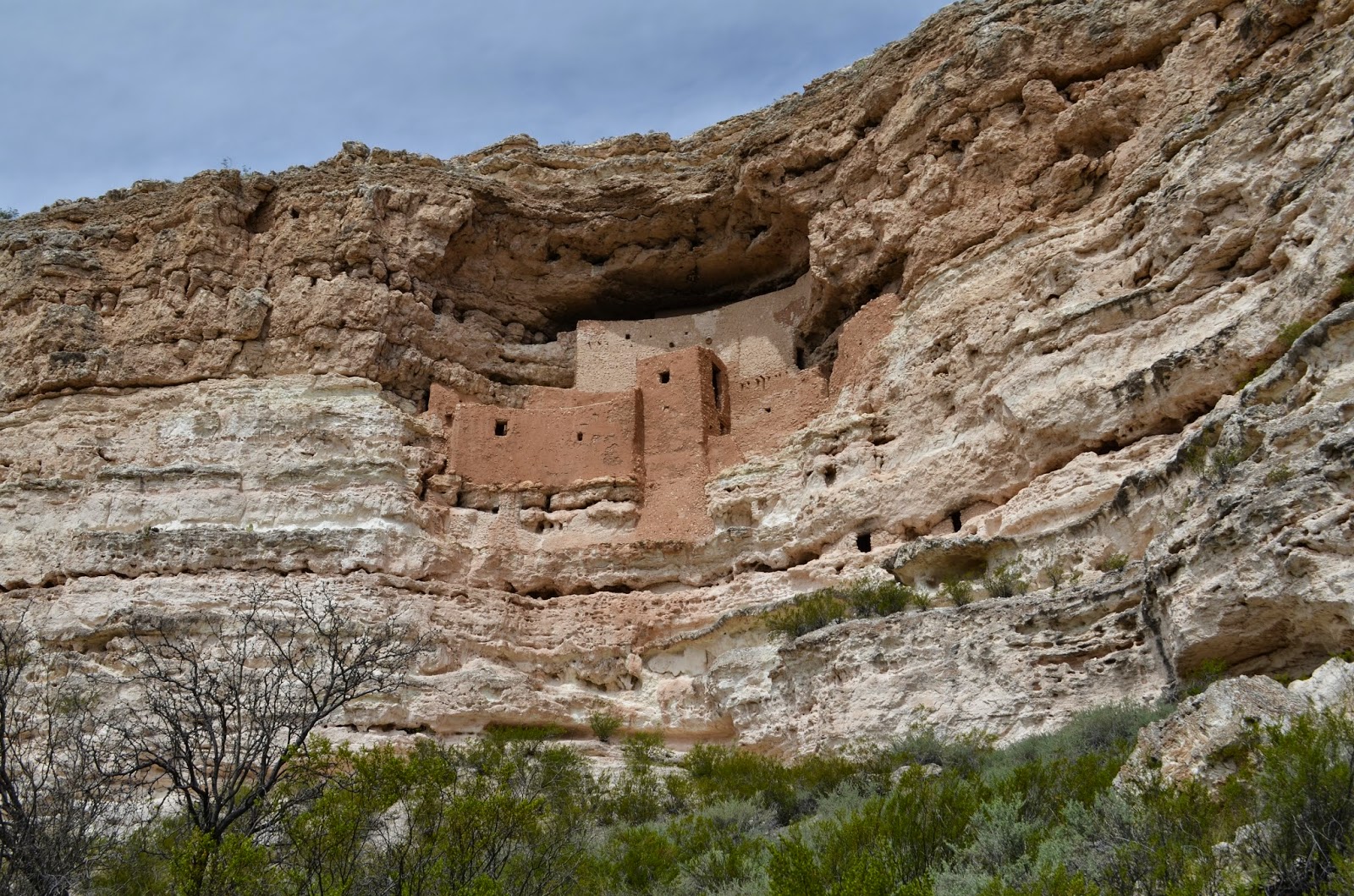
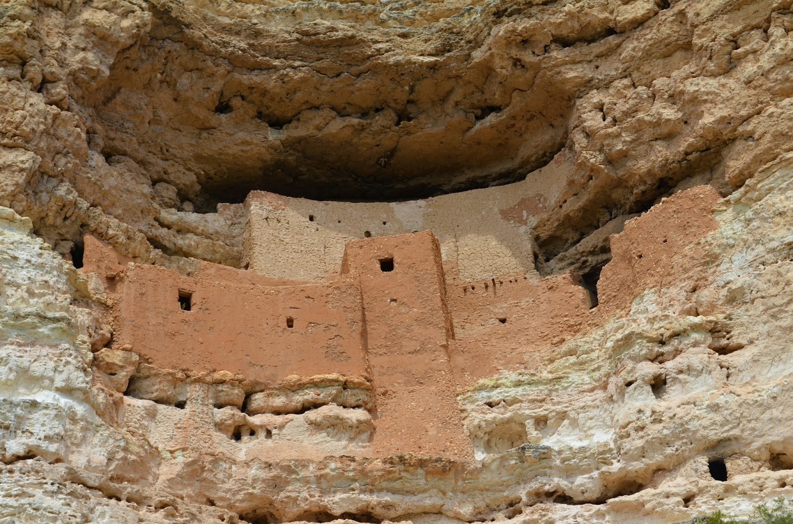
A sign just outside of Camp Verde read "Montezuma's Castle National Monument" so we had to see it. It was a dog friendly national monument with a very short 1/2 mile loop to view the ancient Sinagua dwellings. It was a short stop but well worth it as you can tell from the pictures.


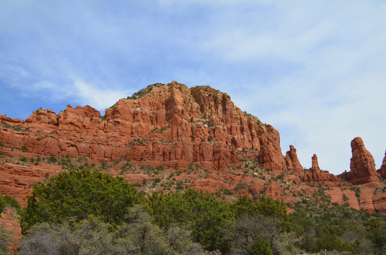
We continued on our way to Sedona. As soon as the car veered off the main highway, the red rocks were visible. The iron oxide from the mineral hematite is commonly found in sedimentary rocks like the sandstone, limestone, and siltstone found in the area.

Sedona is a beautiful place with towering cliffs of red rocks in unique formations every way you look. To me, I feel it could have made a neat national park however people got there first and built it up with small gift shops, ice cream stands, restaurants, and jeep excursions. We stopped at a ranger station in the Coconino National Forest to gather some information on hikes and potential camping sites for that night.


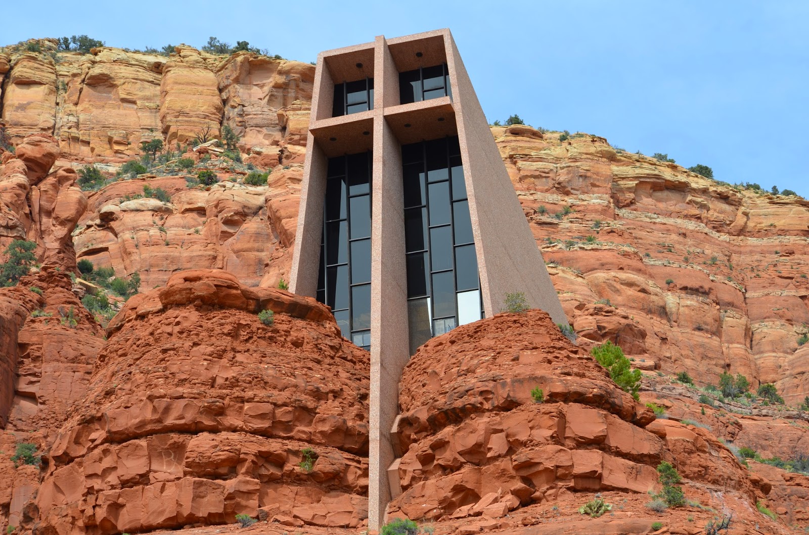
Our first stop was the Chapel of the Holy Cross. It is a beautifully constructed chapel built into the red cliffs. We climbed the 500 ft up the steep winding road to meet the entrance which was all windows overlooking Oak Creek and Sedona. It is a small chapel, 10 pews total with five on one side and five on the other. Pansies and other spring flowers decorated statues of angels near the overlook. It was a popular site for tourists and being Palm Sunday there were a lot of people around. One unexpected happening at the Chapel was a small noisy flight of swallows were continuously going after this thing in the sky. It took several moments before I realized it was a drone... It did not match the reverent and reflective chapel experience. 

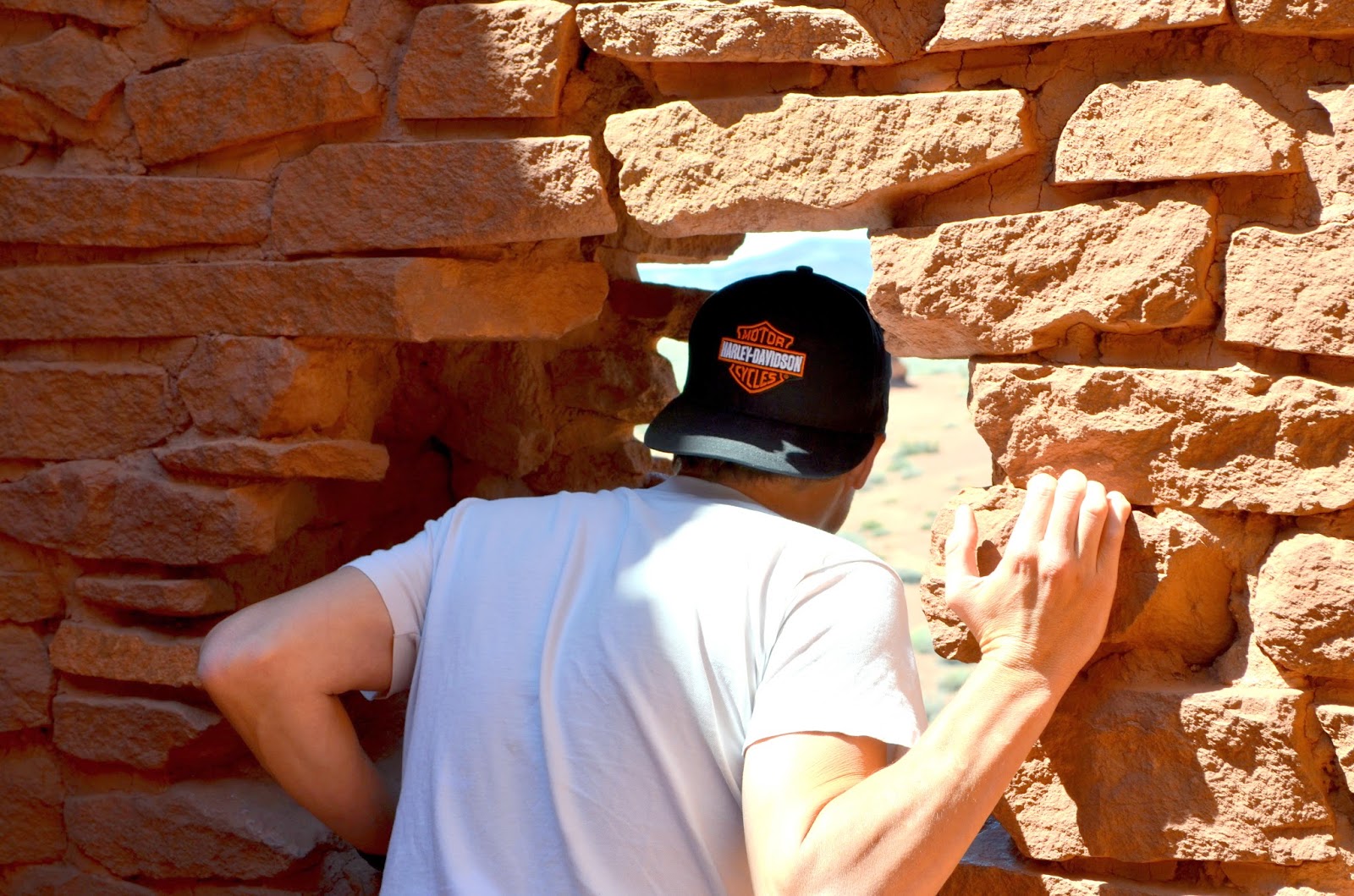
We drove through Sedona to the touristy downtown full of people, shops, etc. Nate picked up a new hat at Harley and we were shortly on our way though the Oak Creek Canyon. If I was forced to live in Arizona all my life but given the choice (and unlimited budget) on where to live, it would be on the water in Oak Creek Canyon. My descriptions cannot even begin to paint how truly beautiful it is. Here is a link to more pictures and the scenic drive.

The water is cold and clear, it rushes over riffles and briskly delivers its live giving abilities to all in the canyon. The greens in the canyon are something that I have missed. There is a mix of broadleaf and needle trees, shrubs, and small flowering plants trying to get their spring on. There is even grass in some areas, which is a welcome sight coming from Phoenix. The rocks are towering and unique. The canyon was eroded by Oak Creek along a normal fault ~65-75 million years ago. As you drive through the canyon on 89A, sandstones, limestones, and even some basalt is visible!

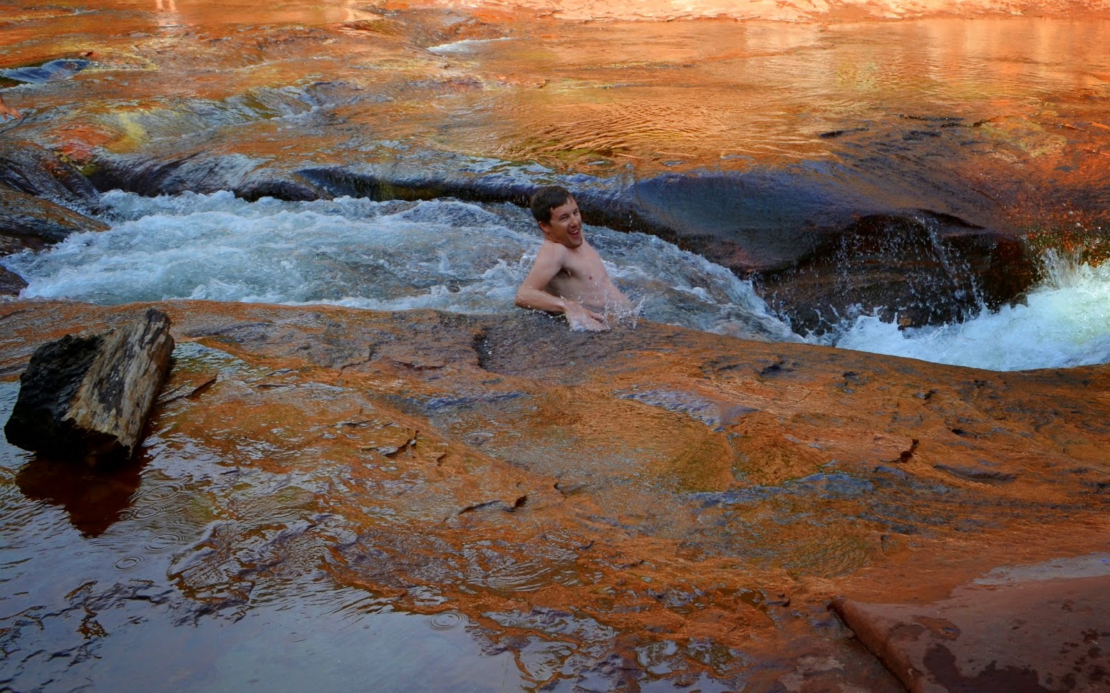
On our way to Phoenix, we stopped at Slide Rock State Park but did not stay long due to time constraints, not this time. We found a place to park on the side of the highway and made the trek down to the creek for some wading, sliding, and swimming. As mentioned before, it was a ridiculously hot day and the creek was packed with people sharing in our idea to escape the hot box of Phoenix. 


After cooling down, we attempted to find a camp site. Our efforts were unsuccessful due to the holiday week, warm temperature, and not all campgrounds being open yet. We pushed on to Flagstaff to catch some great beer (again at Lumberyard), revel in the shadows of the San Francisco Peaks, and plan for the next day. 

There are three National Monuments in the Flagstaff area: Walnut Canyon, Sunset Crater, and Wupatki. There are all within 30 minutes so we started out on our adventures for that day. We began at Walnut Canyon and what I didn't realize was the trails and cliff dwellings all began on the other side of the visitor center. This would normally be no big deal, but I did not have my camera...I took a few on my phone and that will have to do for now. (see facebook and instagram for photos)

The trail down to the cliff dwellings was only about one mile long, however it dropped you down into the canyon 185ft. The trail was had labeled flora and fauna and talked about how people lived in the canyon many years ago. Water is no longer present in the canyon due to drought and water diversion. 

Nate did the trail rather quickly and mountain goat like and I was more apt to take my time reading signs and observing plants I had never seen before. After 185ft down, we had 185ft to go back up...on to explore the next NM.

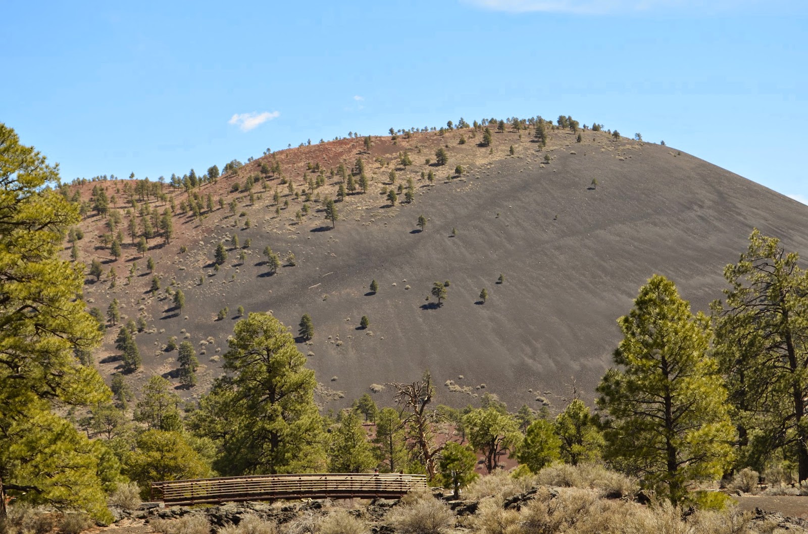
It was only about a 20 mile drive north of Flagstaff to Sunset Crater. It was a beautiful drive with the San Francisco Peaks to our west. The peaks used to big one giant peak in the form of a stratovolcano, it erupted a long time ago resulting in several peaks. Now they rest snow covered and stunning, visible for hundreds of miles with Mt. Humpreys as the tallest point in Arizona.


Our arrival in the Sunset Crater area easy to estimate given the view, the mountain/crater was visible for miles as well. There are over 300 cinder cones in the area north of Flagstaff. I did not anticipate seeing some much volcanic history here. As we drove into the park we stopped at the visitor center to learn a bit more about the volcanics at the park. We continued on the scenic drive past an aa flow, one of the coolest things I have ever seen.


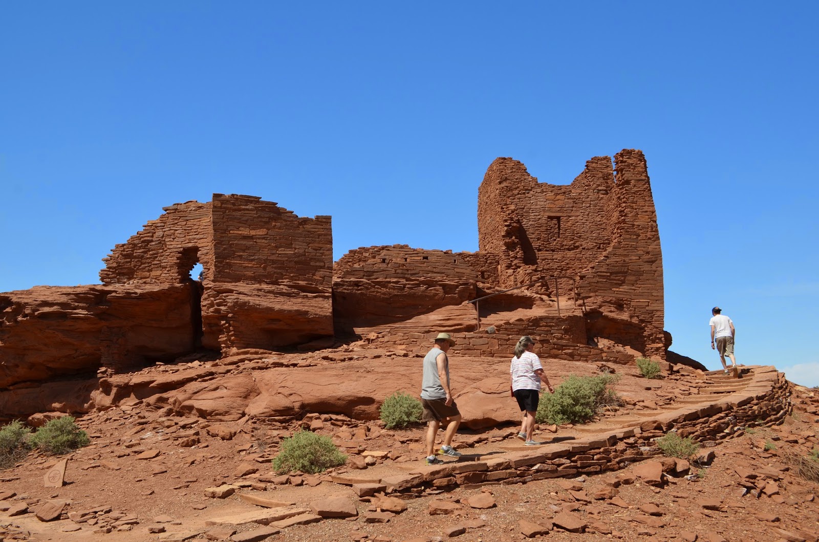
The scenic drive continued through the flows and volcanic areas and headed north to where there were more ancient ruins at Wupatki National Monument. The masonry at this protected location is what makes it so special. Take a look! People were doing this well before we had modern tools, it's just amazing to me to see what people were capable of doing so long ago. It just drives home the fact that we really can do more with less. 


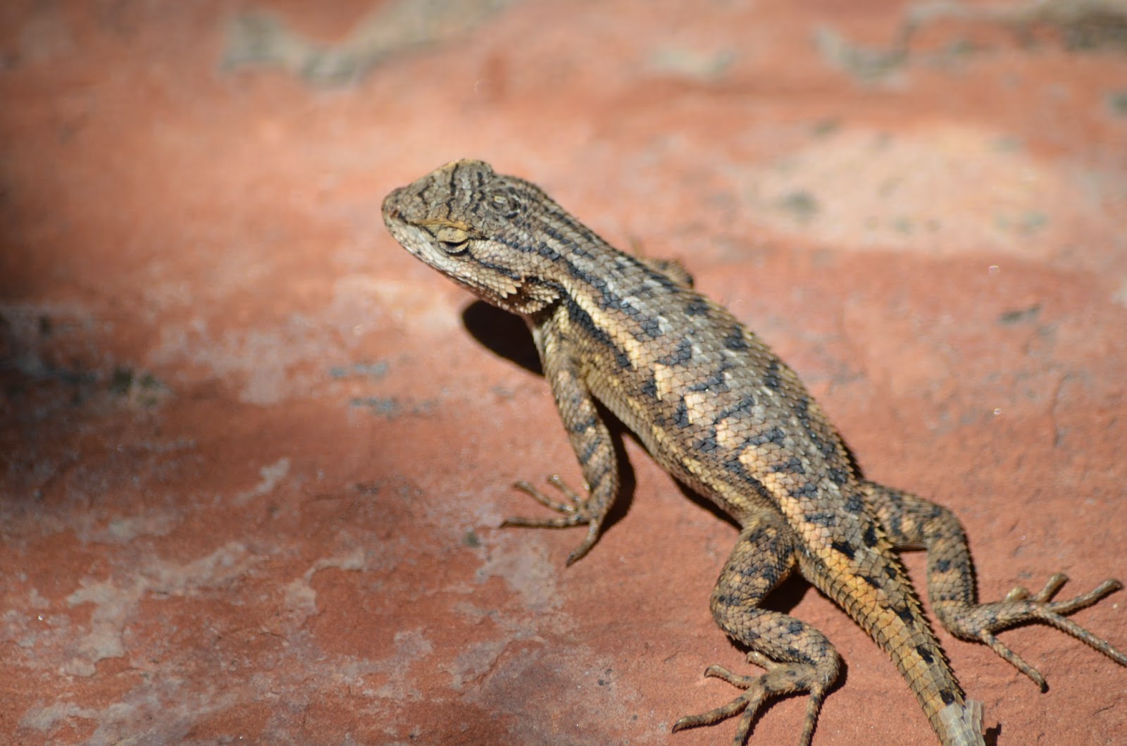
After checking out all Wupatki NM has to offer, we headed back to Scottsdale the scenic way through Jerome and Prescott Valley. We also stopped at Tuzigoot National Monument. It was only about 15 miles off the freeway! When we arrived the temperature had rose drastically again and we were unsure if we would even be able to see the ruins since so many parks and monuments are not dog friendly. We got to hike up there, look at the ruins, and take Kobi! He is becoming quite good at spotting little lizards too.


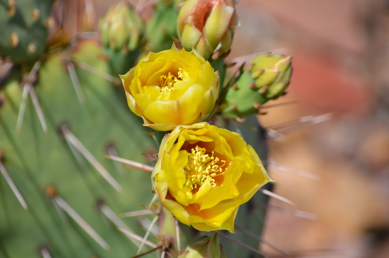
Although there were some nice storm clouds in the distance, they never made it to us in Phoenix. We were fortunate that our off days landed on hot days so we could venture north. There was about a 15-20F difference in temperature because Flagstaff is so much high in elevation. Headed in either direction the flora changes dramatically from light greenish brown plants and saguaros to a more verdant green with broad leaf trees and an occasional prickly pear etc. It was a nice two day getaway.