Showing posts with label Montrose. Show all posts

Saturday, November 15, 2014

Day 4: Black Canyon of Gunnison and Colorado National Park

Waking up in Montrose proved to be a beautiful morning to explore the Black Canyon of Gunnison National Park. We headed a few minutes east to the entrance to the park. We were both surprised when there was a sign on the park station, "No fees during the winter season". I didn't know that the NPS ever waived fees, even if it was cold. 

We carried on to the visitor center to get a map from the ranger. We followed South Rim Road to 11 lookouts along the way. We were unable to hike with Kobi as dogs are not allowed in the inner canyon, so we stopped at all the lookouts. Some of these has short trails a couple hundred yards long and each one was well worth the stop!


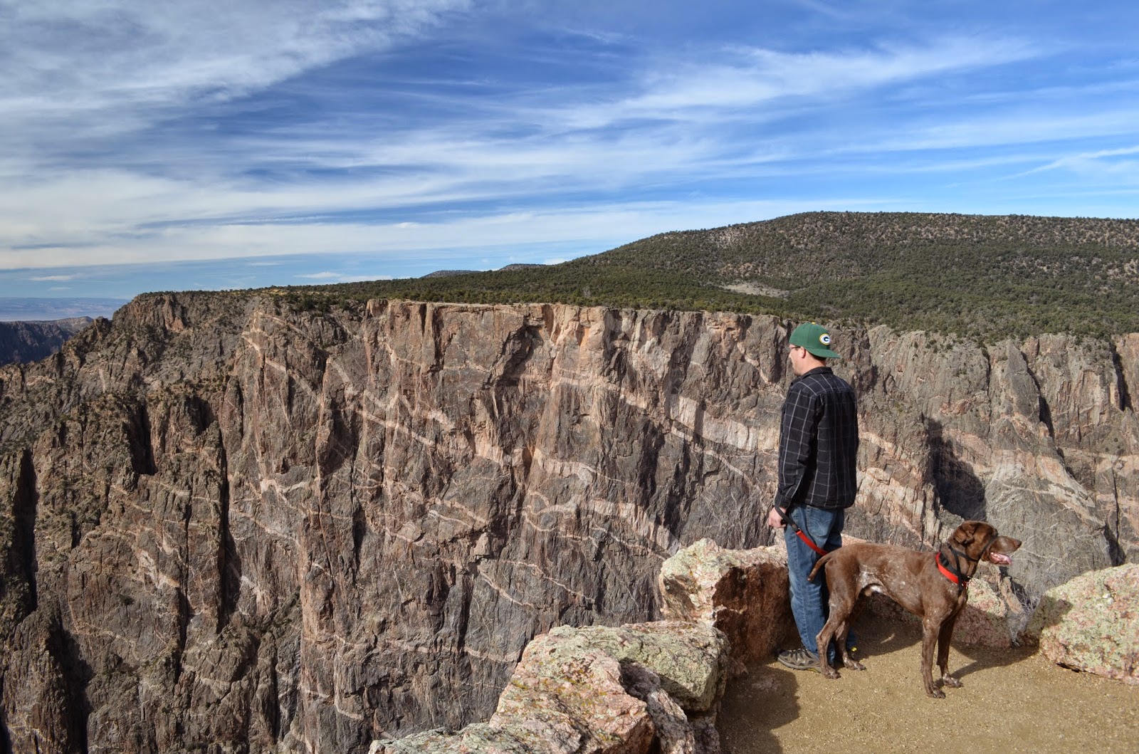
I haven't gone too crazy about the rocks, minerals, or fossils in area of the areas we have visited, however I have to mention a few things here. When the explorers came through this area they called the canyon "black" because of the dark rocks and the fact that part of the canyon only receives 33 minutes of sunlight. The dark rocks are black gneiss, a metamorphic rock. There are also incredible pegmatite dikes running through the canyon like an artist painted stripes on the rock walls. Pegmatites are very cool! These large crystals were formed and are visible because the cooling time was very long, allowing chemicals to form the structure that you see in the large mineral chunks in these walls! There were a lot of micas, both muscovite (light) and biotite (dark). 


The photo directly above is Painted Wall! One of the most beautiful views!!!

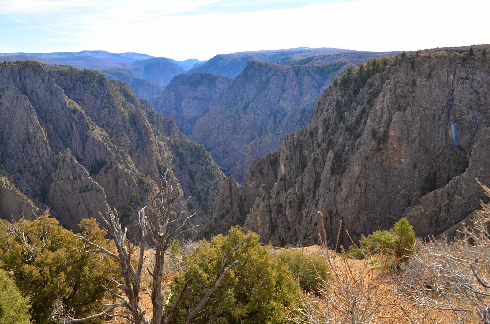
The Gunnison River rages below and many rapids are visible. The river cut the canyon deeper than the Royal Gorge. The first outlook we stopped at was ~1700ft down to the river, whereas the last outlook was more than ~2700 ft down! 

The trails around the South Rim Road were dotted with many junipers, pinyon pine, and the gnarly branches and trunks of trees long gone. There were many yucca which I always thought were cacti, however they are actually the lily family. 

A truly beautiful park! We hopped back in the car and headed westward yet again to the Colorado National Monument near Grand Junction


The Colorado National Monument is appropriately named! There are alternating layers of sedimentary rocks that dance in and out of the scenic drive going through the park. The scenery is amazing, not only because of the sedimentary strata (layers), but because you can see the mountains in the distance, and the city below. The structures within the park are beautiful as well and as you will see above, there were rock climbing on that high pinnacle. As we approached the visitor center, we happened upon a herd of Bighorn sheep. There were young and old, male and female, and hungry and not! Nate snapped these great pictures!

After the Monument, we found a little motel and a brewery to watch the Packers completely destroy the Bears!

Next stop: Home! Or at least the closest thing we have right now.

Day 3: Great Sand Dunes National Park and Preserve etc.

As we were driving to Alamosa yesterday in the setting sun, we didn't even notice that the Great Sand Dunes were visible from the road. We started in Alamosa and drove east on Hwy 160 to Hwy 150. I read in some booklet in the hotel that there is a worthwhile water fall on the way to the dunes, so we decided to give it a whirl.

Zapata Falls was not difficult to find at all. The road to the falls is clearly marked from Hwy 150, although the directions say to take a BLM road there was no need to worry about finding the specific road due to the helpful signage. It was a short 1/2 mile out and back trail. It was uphill there and downhill back. The path was covered with snow and ice and riddled with large granite boulders. The falls were partially frozen upon out arrival but was still a lovely place. I saw a lady hiking the trail with flip flops in all that snow!!!


From the trail head, the Great Sand Dunes were visible however without knowing where and what they were, I may have suspected something else. See the photo below...you be the judge!


The falls were only about 5 miles away from the Great Sand Dunes and we couldn't wait to get there! As we traveled up the road the dunes grew taller and taller. Admission into the park was $3.00/adult which I felt was a royal bargain! We drove to the dunes and got ready to climb!


The sands shift and move as the winds push them, ultimately changing the landscape. There are finer grains of sand on the top and larger grains (pebbles actually) are on the bottom of the dunes. As the wind carries the sediment the heavier, larger grains fall out first leaving the lighter, finer grains settling on the top. We packed up a bag full of water and snacks and set out on our unexpected adventure of climbing the tallest dune at 699 ft. We started climbing and kept going until we could see everything from the top. Honestly, I wanted to quit but Nate kept pushing me and I'm glad he did. It was hard to walk near the top of the dunes on the ridges because your feet just sunk right in. As we walked on the ridges we caused small sand avalanches!

The sand was temperate and felt good on our bare feet. It was warm, but not too hot. In the summer the sand can reach up to 150F degrees ! When we got to the top the sand was quite a bit colder and the view was amazing. We could see two different mountain ranges and an entire valley with dunes!

We ran down the dunes too! Gravity just took us! My feet would sometimes sink into the sand and would sometimes slap and bounce to my next step. It carried us down at least three times faster than what it took to climb up the dunes. Kobi absolutely LOVED the dunes. He was able to run up and down the dunes at will and was happy the entire time! Some people had snowboards to ride down the dunes, which would've been a good time too.

Overall, this was a fantastic experience! I recommend as well! I unfortunately didn't take many pictures on the dunes, I was afraid that I would get sand grains stuck in my lenses. 

I drove westward from The Great Sand Dunes NP on Hwy 112 to scenic Hwy 149. This drive was beautiful. We saw more of the San Juan Mountains which are quite showy and volcanic. We crossed over the Continental Divide as well at 10,000+ ft. I drove for about two hours in the mountains on the way up. It has been quite some time since I drove in the mountains and I was a bit nervous downshifting, braking, and taking the curves with ice on the road. Shorty after we crossed the Continental Divine I pulled over and let Nate drive.

We passed through a really neat little mountain town, Lake City. There were mule deer all over the place; in peoples yards, in the fields, on the roads, etc. The charm and quaintness of the town makes me want to go back some day and spend some time there. We pushed on to Montrose because that was close to the Black Canyon of Gunnison which was the plan for tomorrow.

We drove in the dark on Hwy 50 to Montrose which is a little sad because we according to my geology book, we missed some good stuff. We settled in at the Black Canyon Motel which was incredibly reasonable at $48/night, clean, quiet, pet friendly, and really comfy! Dinner occurred later that night at Horsefly Brewing. There was some great entertainment from a little three piece bluegrass band and the bar was decorated with coasters and bottle caps from breweries all over the world! The beer was great and food okay... I would still recommend. 

Tomorrow, the Black Canyon!